The Library will be closed on Sunday, March 31, 2024, in observance of Easter

Chinatown: On the Map

Glen Creason, Librarian III, History & Genealogy Department,
The Junior League created this tourist map in 1980 showing a festive looking Chinatown
Close up of a Junior League tourist map showing a festive looking Chinatown, [ca.1980]

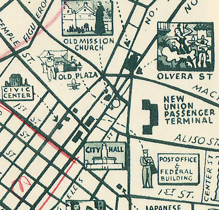
Chinatown in Los Angeles has been demeaned and misunderstood for about a century and a half. It has never been considered the equal of the much more famous entities in San Francisco or New York but it was always just as important for immigrant communities who searched for a place in the so-called City of Angels. The reasons for the vagaries of our Chinatown range from overt racism to xenophobia to real estate economics. The fortunes of this small slice of downtown have wavered up and down dramatically and are still in flux as Chinatown is once more being reinvented just as it was in the 1890s, the 1930s, the 1980s and whatever you call this decade. Originally “Chinatown” was just a block-long, 50-foot wide dirt street also known as Ferguson’s alley but as the 20th century approached the place grew to many streets and some two-hundred buildings that featured profuse residences, an opera theater, several temples, and even a Chinese language telephone exchange. The neighborhood existed because Chinese laborers produce men, shopkeepers and domestics were not allowed to vote, to own property, to have their own businesses and farms. These economically challenged immigrants gravitated toward the comfort of their families in the area. Even in their own neighborhood they faced terrible discrimination and shared that end of the old pueblo with the poorest of the city’s population.

map was made in 1929 by the Women’s University Club depicting the city in 1871

Site of Chinese Massacre under number 13 where 18 innocent men were killed in a xenophobic riot. This map was made in 1929 by the Women’s University Club depicting the city in 1871 when the club was formed.

Border illustration of site of lynchings during Chinese massacre of 1871

Border illustration of site of lynchings during the Chinese massacre of 1871
Border illustration of site of lynchings during Chinese massacre of 1871
Border illustration of the Chinese participation in the “Fiesta de las Flores”

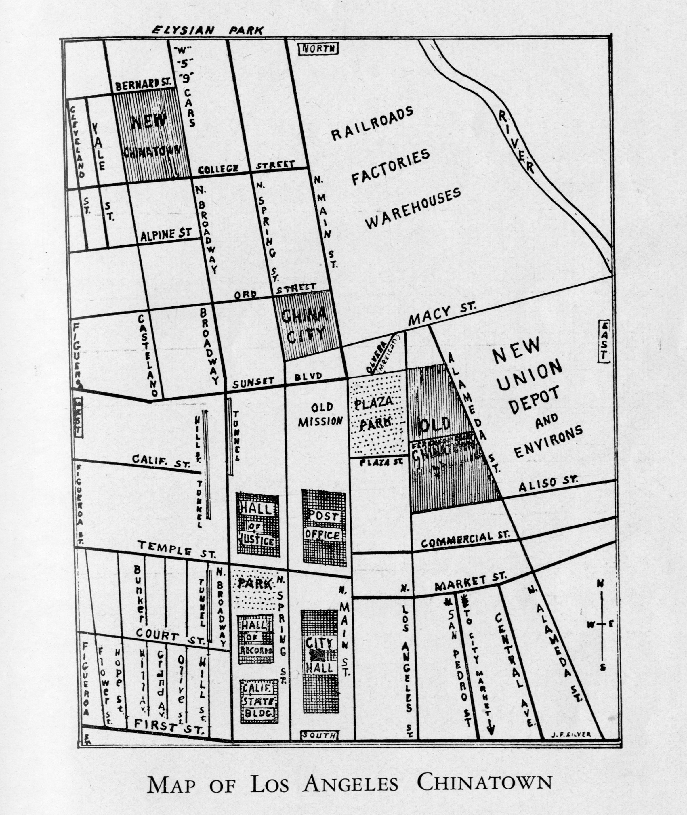
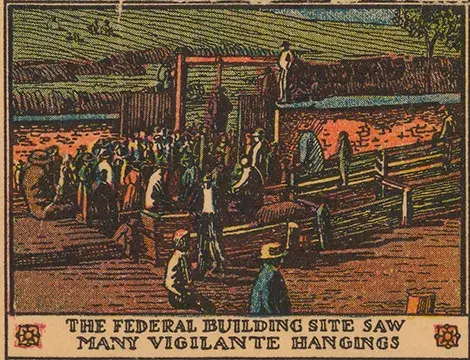
Yet, in popular imagination, Chinatown here was a hot-spot of illegal activity, and the lawless streets drew a certain crowd from the area to drink, gamble and find company in the arms of fallen angels. The strange cartographical phenomena of Chinatown is that it was often ignored since the streets may have seemed unsavory and out-of-towners were not encouraged to visit, that is until a suggestion might be made by locals who liked the high-life. However, we do have several intimate looks in the Dakin Atlas or our Sanborn Fire Insurance atlases that name the dens of sin and label Opium joints, saloons, tenements, gambling establishments, and buildings labeled I.F. for houses of ill fame. While the common street guides or fold-out maps show a dot on the map old Chinatown was a place of many stories where families lived good lives alongside shady operations where rubes were fleeced and Angelenos wiped their brows with the devil’s kerchief.

Dakin Map
Another type of Fire Insurance atlas that shows the old Chinatown in living color. This one is a little more explicit with marking “IF” for houses of Ill Fame and even Opium Joints marked on certain establishments. Dakin Atlas: 1891

Cram map from atlases of the day 1901 which does not identify Chinatown but does show Ferguson’s alley, at the heart of the neighborhood.
Rueger’s map of the city in 1902, once more excluding name Chinatown but including Ferguson’s alley.Rueger’s map of the city in 1902, once more excluding name Chinatown but including Ferguson’s alley.
Sanborn Fire Insurance Atlas of 1888 showing details on buildings and activities
Chinatown 88: Sanborn Fire Insurance Atlas of 1888 showing details on buildings and activities in the neighborhood in the peak years. Including the Chinese Theater, Female Boarding, Gaming Parlors, restaurants, Carriage sheds. “S” for stores and “D” for dwellings.

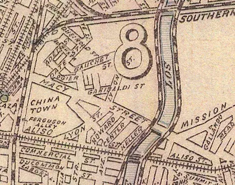
There are plenty of arguments about the locations of local history around Southern California and the internet swarms with know-it-alls and true scholars who will fight to the death of reason over spots on the map. The whereabouts of the original pueblo, the actual Tongva village of Yangna, the big sycamore tree known as El Aliso, Frenchtown, Sonoratown, the Zanja Madre and the tunnels of the Lizard People are the subjects of constant battles over location, location, location. In the case of Chinatown, we have archaeological evidence of the people and places that were founded by Cantonese coming here to escape famine and oppression. Unfortunately, the oppression they found here was brutal and part of the reason why Chinatown became what it was for over half a century. Some of these maps tell the story of this colorful but sometimes tragic part of town.

A Baist Atlas showing Chinatown after the turn of the 20th century without the seedy detail of the Dakin

Chinatown,1905. A Baist Atlas showing Chinatown after the turn of the 20th century without the seedy detail of the Dakin. This looks shows a “negro alley” which was originally called “calle de los negros” which was just a place where dark-skinned residents from Sonora once lived. The name morphed into a racist term that unfortunately appears on many maps of the day.
From 1909 masterpiece Birdseye Map of Los Angeles clearly showing boundaries of Chinatown, including buildings.

old map of Chinatown

Another beautiful map done by the great Laura Whitlock for Hill’s maps in 1923 clearly showing Chinatown in days when the place was considered rather seedy and lawless.
Rider’s Travel Guide of 1924 showing Chinatown but leaving much unsaid in the guide text.Rider’s Travel Guide of 1924 showing Chinatown but leaving much unsaid in the guide text.
Spyglass map of LA in 1935 now the site is covered by new Union Depot. Generations of Chinese families just paved over.

Sightseeing map of Los Angeles and Hollywood 1940

Sightseeing map of Los Angeles and Hollywood, 1940. Done by the All Year Club to encourage tourism with new Chinatown and China City both on the landscape.
Map from book inside Los Angeles Chinatown
Map from the book Inside Los Angeles Chinatown by Garding Lui that gives a perfect look at the old and the new.

Sanborn Atlas on the site of the original Chinatown

A later look at a Sanborn Atlas on the site of the original Chinatown with the changes brought about by the construction of Union Station represented by pasted over slips of paper. The old structures are still visible under the white pastings.

Over a few blocks is “new” Chinatown  in 1950 with Jing Jing Road and GingLing Way amongst others.

Over a few blocks is “New” Chinatown in 1950 with Jing Jing Road and Ging Ling Way amongst others.

What to see and do downtown 1960

What to see and do downtown 1960. With the stereotypical China Doll representing the resurgent Chinatown with restaurants and shops drawing folks to that part of downtown.

LARY Transit lines 1945

LARY Transit lines 1945, showing lines of the Yellow Cars and buses with Alligators and Ostriches shown but Chinatown is not.

Thomas Brothers Street Guide 1961, showing China City and the still “New” Chinatown.

Tourist map from 1980 showing a festive looking Chinatown

The Junior League created this tourist map in 1980 showing a festive looking Chinatown ironically about the time restaurants and customers began heading to the San Gabriel Valley.

Related Event


March 16, 2019 · 1 - 3:30 p.m., Central Library

Join us for a free film screening of the film Chinatown (1974) as part of our Big Read 2019 celebration. The film screening will take place after a brief presentation touching on stories of immigration and gentrification.


Top