Halloween se ha convertido en una gran celebración de un mes en estos tiempos modernos, y no solo por dulces y muerte, como recuerdo que significaba cuando era niño. Ahora, los adultos se disfrazan tanto como los niños, y en las fiestas hay menos búsquedas de manzanas y más cervezas artesanales que hacen olvidar a los participantes que este día está dedicado a los difuntos. Hay alrededor de ochenta parques del sueño eterno en el condado de Los Ángeles, y hemos tenido lugares donde los espíritus podían vagar desde los inicios del pueblo.
La plaza planificada, que se muestra a continuación, ya contaba con parcelas para los cementerios, y el primer cementerio público data de tiempos tan remotos que el primer hombre enterrado allí fue asesinado por un oso en las montañas de Santa Mónica. El primer mapa topográfico de la ciudad muestra dos cementerios y la calle Eternity, que no necesita mucha explicación. En sus inicios, los cementerios no eran de tipo cooperativo, y las familias debían mantener y proteger las tumbas, que a menudo se desmoronaban con el paso de los años, al igual que sus parientes. Muchos cuerpos fueron trasladados de cementerios antiguos a nuevos, y algunos simplemente fueron pavimentados a medida que el progreso expandía la ciudad de Los Ángeles. Aquí se incluyen algunos de los cementerios más destacados de la ciudad, y algunos se excluyeron simplemente porque no se visualizan bien en los mapas.
Plaza Cemetery - From a plan created by Jose Arguello laying out the original pueblo including the cemetery that served the settlement until they began transferring bodies to the city cemetery up in the hills above the plaza.
Camposanto at the San Gabriel Mission - From 1778 to 1865 these grounds were the resting place of thousands of Gabrieleno Indians and settlers around the Mission.
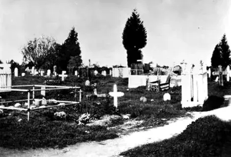
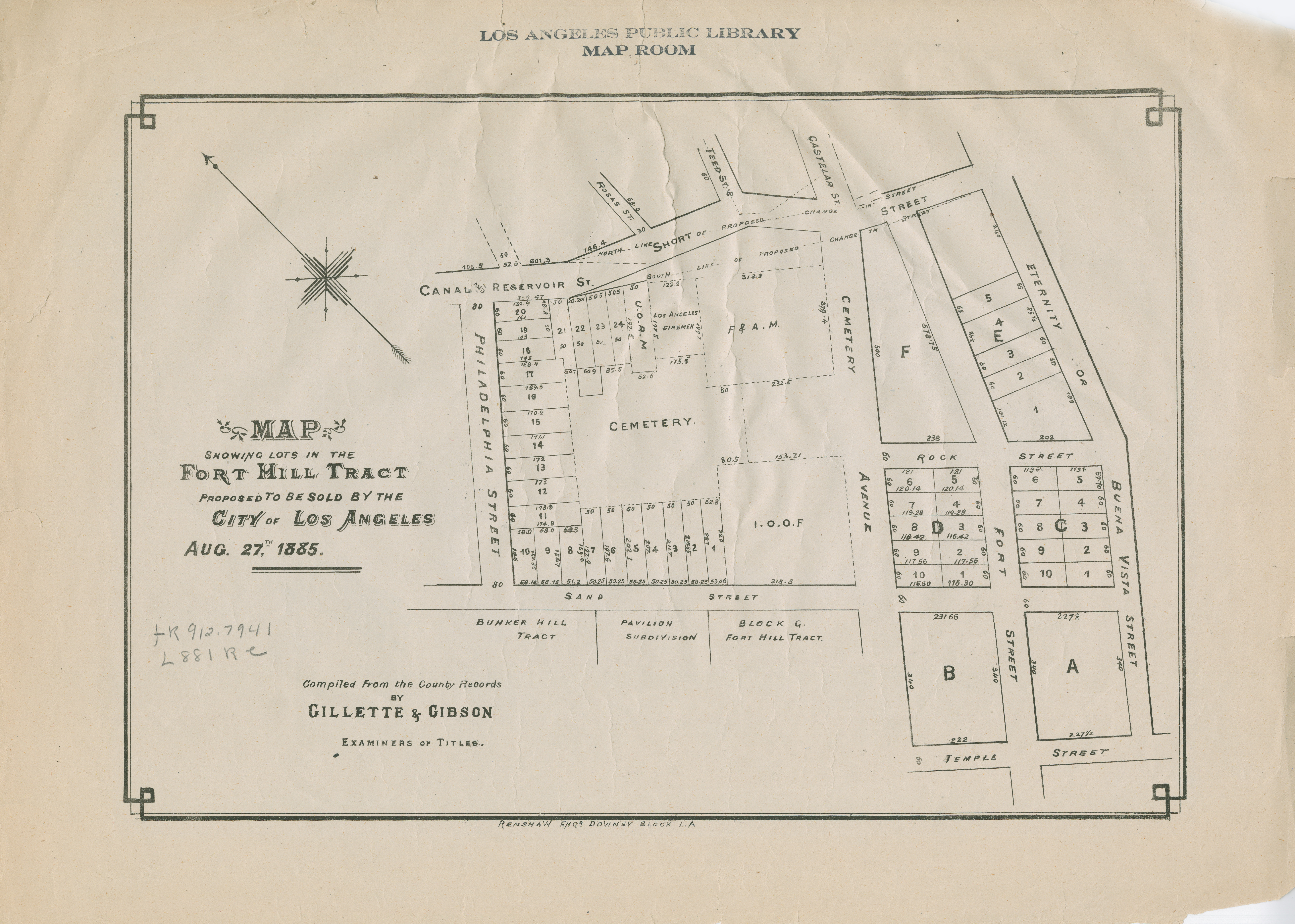
Fort Hill Cemetery - Founded in 1853 where anyone could lay a loved one in the ground but then tend to the plot as there was little public cooperation in this graveyard.
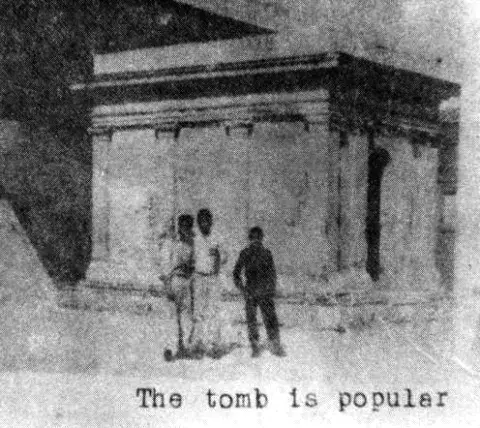
Fort Hill Mausoleum - A type of interment reserved for the wealthy at the time.
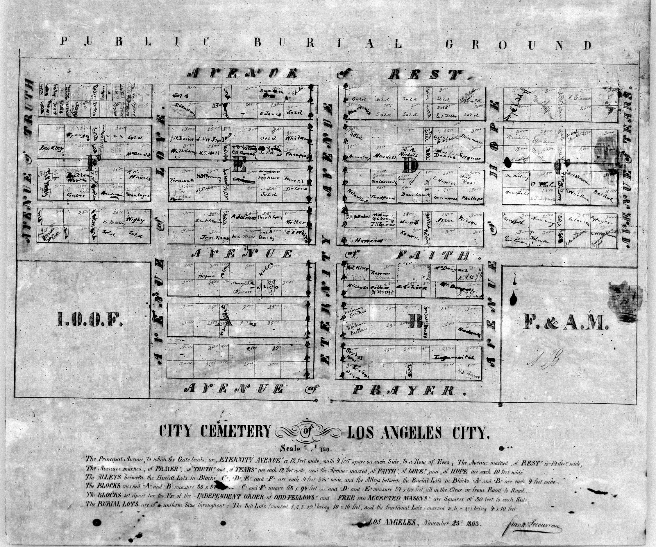
City Cemetery - A detailed look at the first public burial ground around 1863, now fallen into disrepair but bearing the names of those interred in the grounds that would eventually be moved to other cemeteries like Evergreen, Rosedale or New Calvary.
Old Calvary - The early Roman Catholic cemetery that sat in the hills where Cathedral High School now exists. The chapel of the old graveyard is maintained in St. Peter’s church on North Broadway.
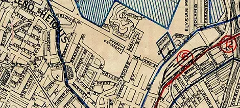
Old Calvary/Hebrew turn of the century map detail showing old Calvary and Hebrew Cemetery.
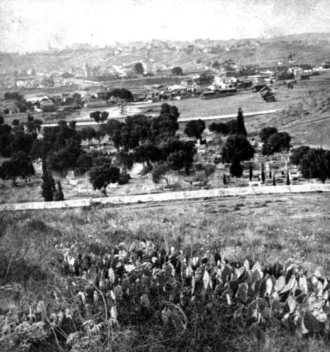
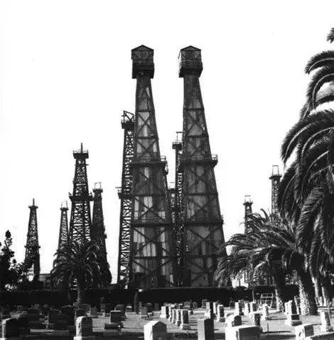
Evergreen Cemetery - Founded in 1877 to accept the overflow from the growing city that eventually grew to 300,000 graves. Evergreen was also the place where a Potter’s field was maintained to bury the poor and indigent.
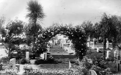
Evergreen - The front gate of the new cemetery adorned with grand landscaping.
Evergreen - Seen in 1921 in the heart of Boyle Heights.
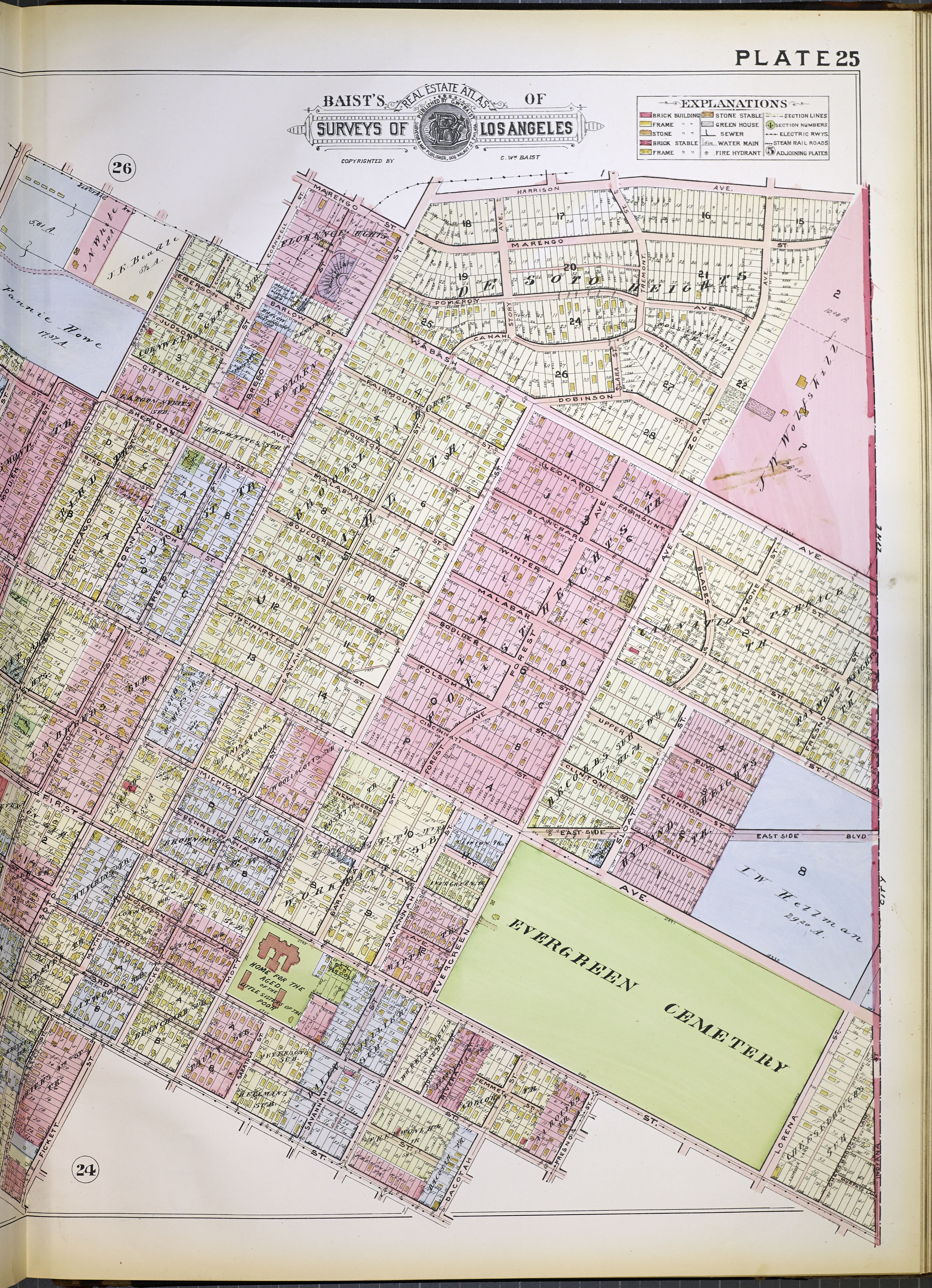
New Calvary - When Old Calvary became overcrowded many of the graves were moved out to this 137-acre spread at the edge of East Los Angeles in 1896. 1931 Gillespie guide. Barely visible at the bottom is the B'nai B’rith Jewish Cemetery that was moved from near Chavez Ravine.
New Calvary grounds - Sanborn Fire Insurance Atlas Vol 14, [1930].
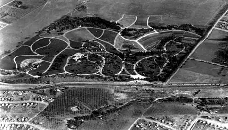
Rosedale founded in 1884 at the peak of the population boom Rosedale offered 65 acres of the new-style lawn cemetery open to all races and creeds.